Photos plotted onto Maps
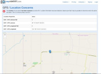
We are excited to announce a new feature on the snapWONDERS platform. If you analyse a photo that has GEO Coordinates / GPS information then they will be plotted onto a map.
This was implemented based on the feedback that we received from many of our users. Thanks everyone for your feedback.